4 September 2014
A project is underway in southern Cape York which aims to help ranger groups address threats to wetland health, including weed invasions, sedimentation, and damage from feral animals. 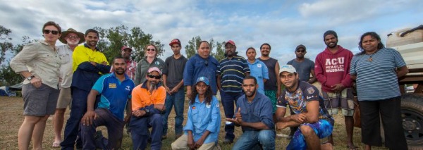
The project draws together the expertise of the Yintjingga Aboriginal Corporation’s Lama Lama Rangers, the North Australian Indigenous Land and Sea Management Alliance Limited, local NRM group South Cape York Catchments and Griffith University.
The project team has been undertaking field trips since June 2013, sampling 14 sites across the jointly-managed Lama Lama National Park (Cape York Peninsula Aboriginal land) Silver Plains, Lilyvale, and Running Creek Nature Refuge, near Coen and Princess Charlotte Bay.
Three sampling trips have allowed the team to build on wetland condition assessments carried out in 2009 and 2010 with support from South Cape York Catchments, using a methodology developed by Cape York Marine Advisory Group Environmental Inc.
Managing threats affecting local waterways is a high priority for the Lama Lama Rangers because the sites being monitored are both culturally and environmentally significant. The condition assessments yield data that helps the rangers prioritise and target their ongoing management efforts.
Pigs are one of the most significant threats to wetland health in the area because they dig up the damp soil around the edges of the swamp, looking for roots, tubers and plant bulbs, freshwater mussels, turtles and their eggs, and even frogs. As the water recedes over the dry season, pigs, cattle and horses move inward with the shrinking wetland edge, damaging large areas and polluting the water. This disturbance causes the waterholes to dry up faster than they would in the absence of these introduced animals.
The Lama Lama Rangers are making significant efforts to reduce these impacts with the help of the condition assessments. Pigs are targeted with baiting and aerial shooting programs (in partnership with Queensland Parks and Wildlife), and key wetlands are being fenced to keep pigs and other introduced animals out.
The research team is using a range of sampling techniques to assess wetland health, including consecutive visits to marked monitoring points to sample water quality, feral animal impacts, bank stability and other aspects of the wetland environment. Researchers from Griffith University are also using satellite imagery to generate a historical dataset of the wetlands’ inundation patterns, turbidity and aquatic vegetation dynamics.
A key outcome of the project has been the development of a rapid wetland assessment method supported by a customised I-Tracker application to capture and manage the data. This gives the rangers a tool that is straightforward enough to use once or twice a year at each site, allowing them to keep a close eye on any changes to wetland condition, and assess and adapt onground management actions accordingly.
Read more about this project or view a map of the study area.
Want to know more about the Resilient Landscapes Hub's activities and our research into practical solutions to environmental problems? Stay informed about activities, research, publications, events and more through the Hub newsletter.