10 July 2018
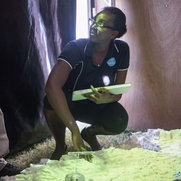
A 3D model of WA’s Fitzroy River catchment is supporting knowledge sharing and decision-making about country by Traditional Owners.
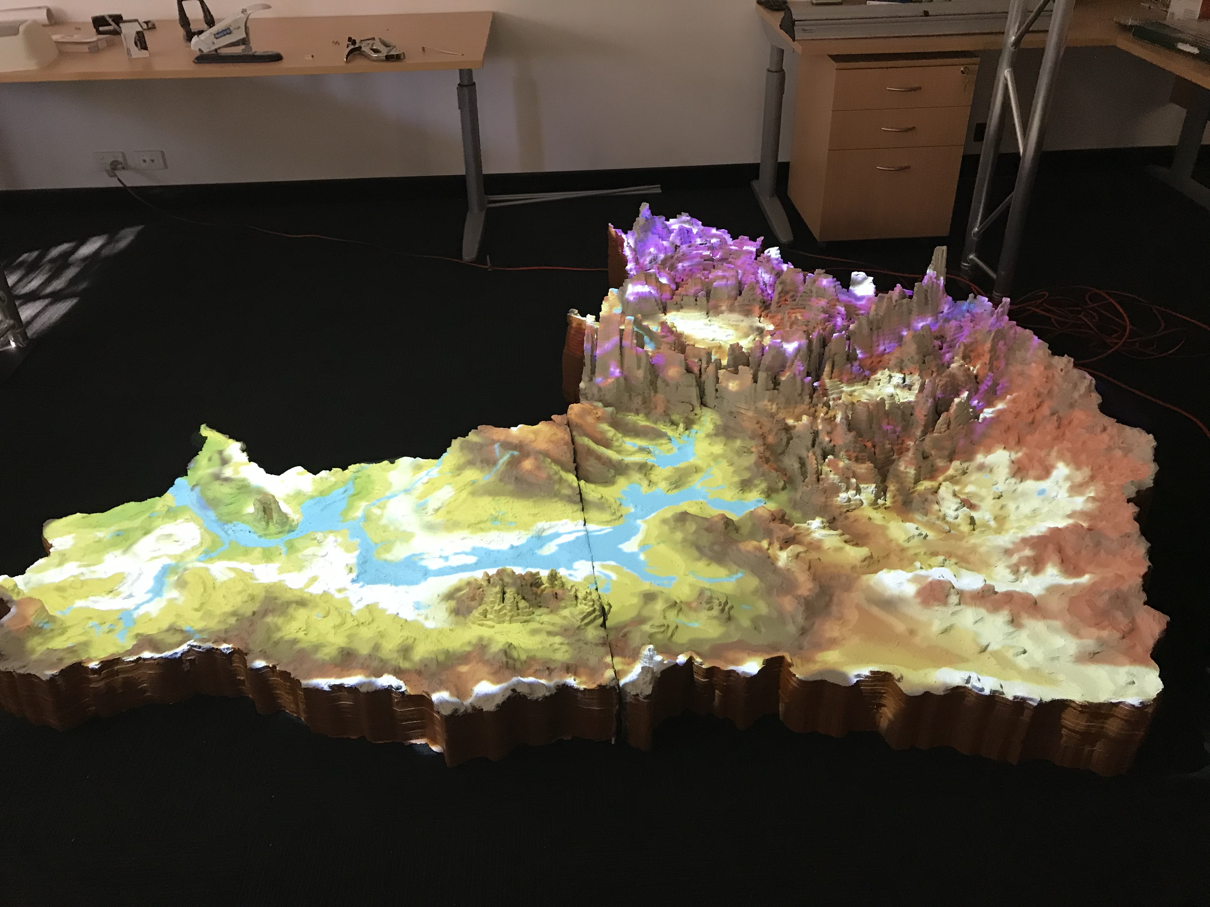
Construction of the model involved Traditional Owner schoolchildren in Fitzroy Crossing working with Hub project leader Dr Ro Hill and researcher Nat Raisbeck-Brown (CSIRO) to build the model out of foam contour shapes. The model was finished in Perth, by smoothing the contours with gel and painting it white.
The surface of the model is soft and flexible so that pins can be added to mark important places and tracks. This allows Traditional Owner groups to show one another places of cultural significance, knowing they can take the information (pins) away later to protect their cultural and intellectual rights, or to save the data as spatial files if they choose. The white surface provides a platform onto which spatial data can be projected, bringing western science knowledge to the model and allowing overlays of different data layers to assist decision-making about locations for conservation and development opportunities.
The model provides a place where Indigenous knowledge added by the Traditional Owners and western science knowledge can interact, showing where and how they overlap in the catchment. Read more about the model here or watch this video outlining the process.
Want to know more about the Resilient Landscapes Hub's activities and our research into practical solutions to environmental problems? Stay informed about activities, research, publications, events and more through the Hub newsletter.