15 November 2021
Ranger uranium mine is surrounded by Kakadu National Park. The mine has ceased operations and rehabilitation works are due to be completed by 2026.
Spring-fed monsoon vine forests and riparian (riverbank) vegetation in the area depend on soil and groundwater, and provide essential habitat for the highly diverse aquatic ecosystems of the freshwater Magela Creek which flows through the mine lease. Weathering of waste rock from the mine releases contaminants, including magnesium sulfate, the main contaminant of concern. These contaminants are washed out by the rain and are predicted to move through the local groundwater towards Magela Creek.
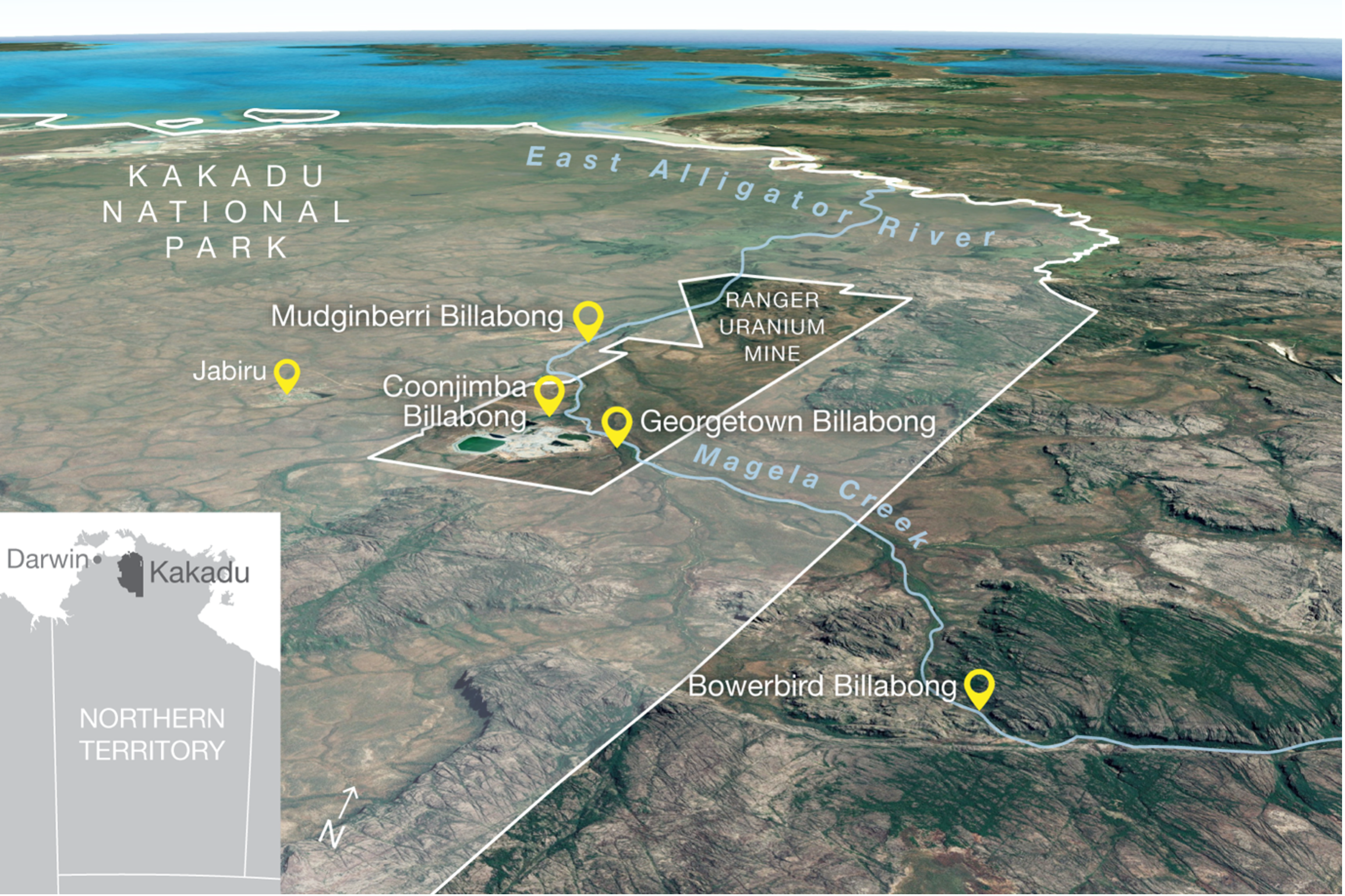
Location of Kakadu National Park, Magela Creek, Ranger uranium mine and the four billabongs where fish were collected, tagged and detected.
Two Northern Australia Hub projects, led by researchers from Charles Darwin University, are ensuring that comprehensive ecological information about the parts of Kakadu that surround the mine site can help guide the rehabilitation works at Ranger.
The riparian vegetation project looked at contamination of shallow groundwater with mine wastewater after rehabilitation of the site and how this could have significant impact on riparian vegetation and stream health. The fish movement and sensitivity project assessed the possible effects of contaminated water on Magela Creek, which is home to important populations of native fish species that need to be able to move between the river, floodplain and escarpment country at different times of the year.
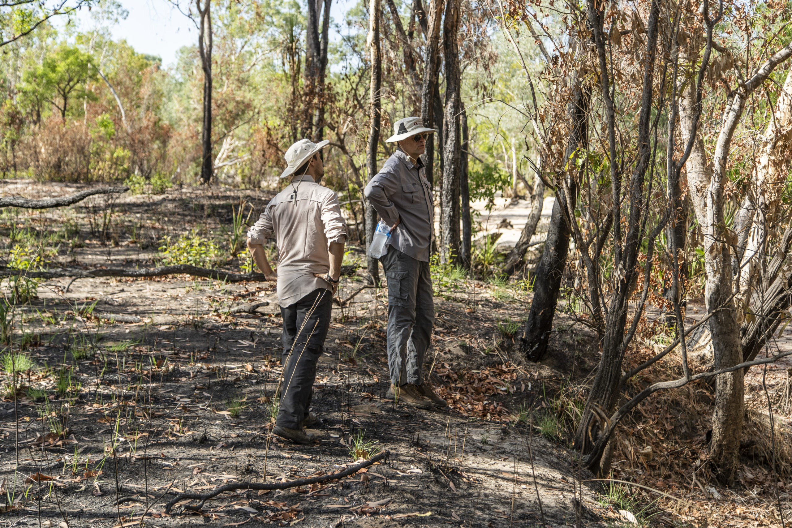
Project team assessing Magela Creek riparian vegetation. Photo NESP Northern Hub.
The riparian vegetation project greatly improved knowledge about how riparian trees in this part of Kakadu were using various water sources in the creek channel, on the upper banks and out on floodplains of Magela Creek. Riparian trees are most likely to draw on potentially contaminated shallow groundwater during the dry season, and trees on the floodplain may draw on potentially contaminated deeper bedrock groundwater in very dry conditions.
However, riparian species are unlikely to be severely impacted by magnesium sulfate at (and even greater than) the concentrations they are predicted to be exposed to after rehabilitation. No significant growth impacts were observed across the eight species tested in the greenhouse sapling experiments conducted in conjunction with researchers from UWA. Additional work is required to determine in situ responses of more mature vegetation in contrast to the sapling-focused greenhouse trials from this project.
Discover more findings on the project page or read the final report.
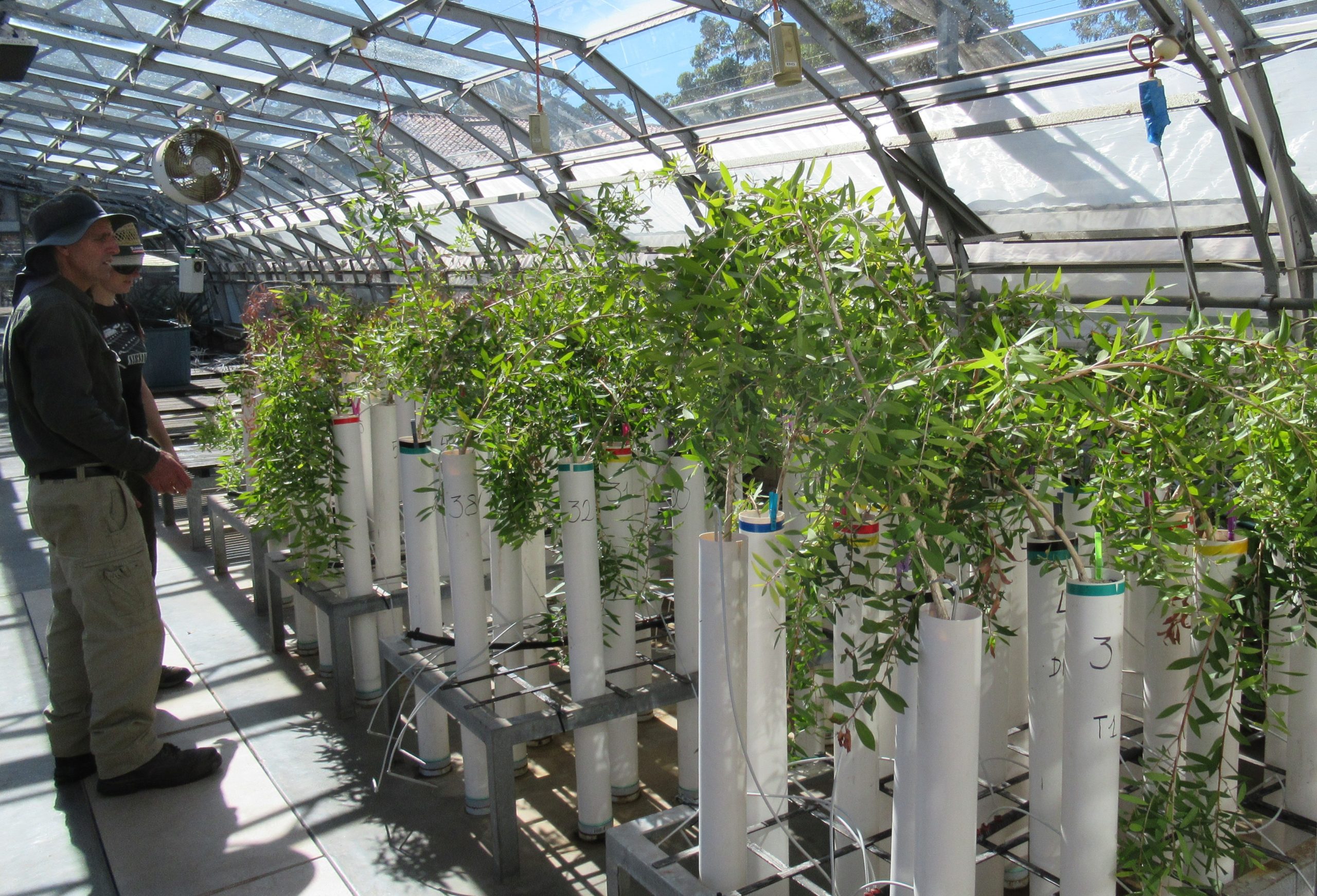
Measuring plant height regularly helped to identify any positive or negative effects on plant growth. Photo Fi Freestone.
The fish movement project collaborated with the Djurrubu Rangers to understand how large-bodied fish were moving through the Magela catchment. The researchers found that a significant proportion of tagged fish (~30%) migrated >18 km downstream into the mine lease during the wet season. Movement started soon after the first wet-season flows, and most fish migrated back upstream into their previous home range at the end of the wet season.
The researchers found that the sand channels of Magela Creek past the mine are a critical migration pathway for fish due to the connections between lowland reaches of the system and the escarpment refuge billabongs. These migrating fish are most likely to encounter mine wastewater during the wet season but this coincides with the highest flows, which may dilute any mine-related contaminants and reduce the risk to fish. Ongoing monitoring is required to identify legacy impacts and facilitate mitigation of any disruptions to fish assemblages and migration through Magela Creek.
Discover more findings on the project page or read the final report.
These two projects complement the previously completed fauna rehabilitation standards for Ranger uranium mine project.
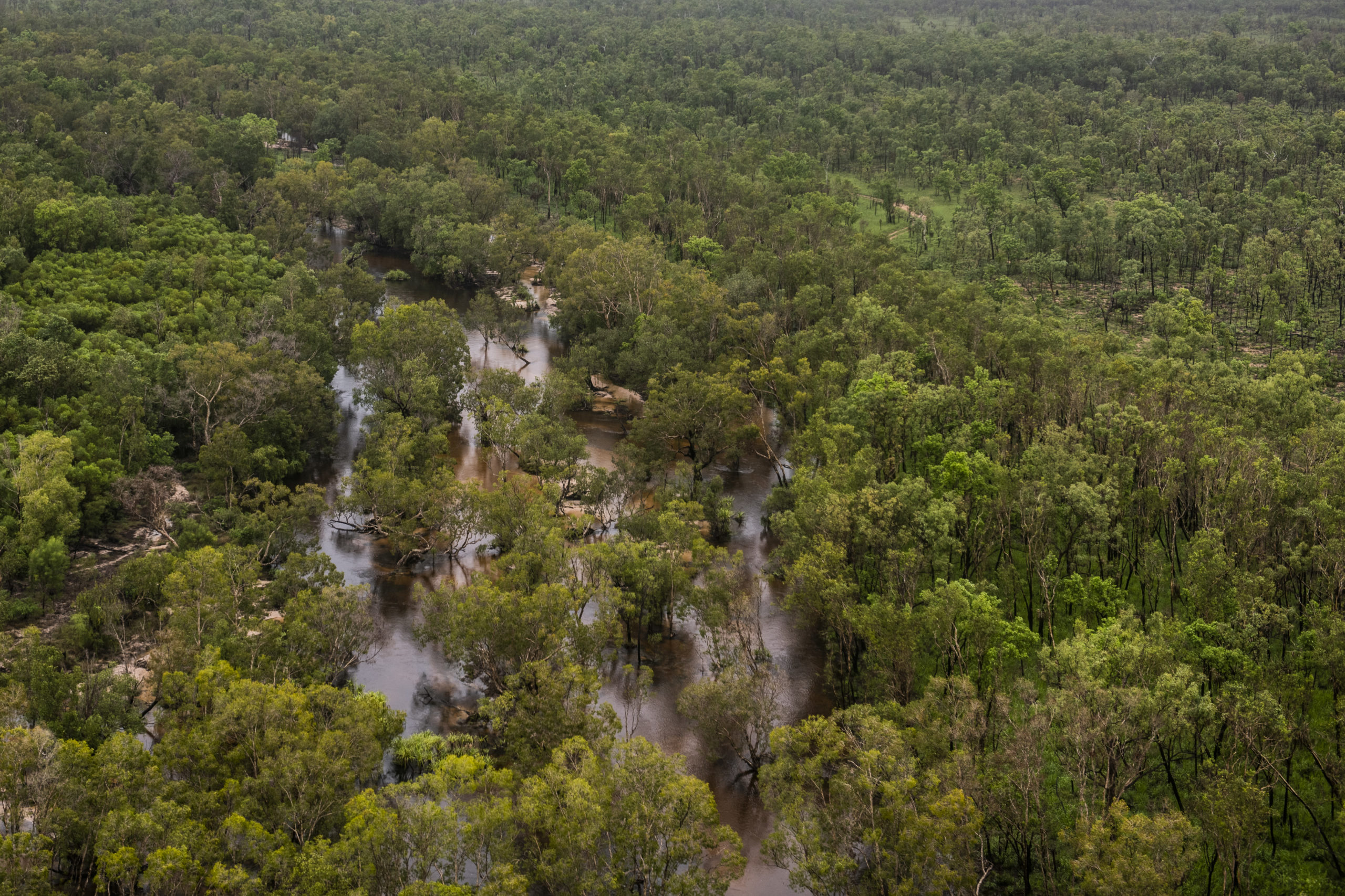
Magela Creek in the wet season. As these flood flows recede, the water table suggests that sub-surface flow occurs from shallow parts of the weathered bedrock aquifer to the sand-bed area.
Want to know more about the Resilient Landscapes Hub's activities and our research into practical solutions to environmental problems? Stay informed about activities, research, publications, events and more through the Hub newsletter.