Northern Australia is rugged, remote and sparsely populated – a good thing for ecosystems and biodiversity. However, the sheer vastness of the region makes it challenging to understand, quantify and manage threatened species and threatening processes. For management of species and habitats to be targeted and effective, we need to know where they are and how they respond to these threatening processes.
The Northern Australia Environmental Resources Hub is supporting better development decisions and informing management by producing high-resolution maps of threatened species and habitats – such as northern quolls and tropical littoral rainforest – and threatening processes such as invasive gamba grass and altered fire regimes.
It’s not enough just to know where the species, habitats and threats are. Understanding the impacts of threatening processes can support targeted management and mitigation actions. Hub research has shown it’s possible to break the destructive gamba grass–fire cycle and create an alternative ecosystem trajectory towards restoration. Understanding how salty mine wastewater might affect nearby freshwater ecosystems will inform the rehabilitation of Ranger uranium mine, which is adjacent to the World Heritage- and Ramsar-listed Kakadu National Park.
This successful collaboration between researchers and government responded to the increasing calls for agricultural expansion and other development across northern Australia by generating over 1,500 maps of ‘conservation concern’ species, threatening processes, and species’ vulnerability to threatening processes. These maps are already being used in development and conservation planning and prioritisations through protected area evaluation and investment, strategic regional assessments, catchment-level development guidance, land rehabilitation and several research projects – delivering conservation and biodiversity outcomes across the north.
Discover more project findings and read about how to access the data.
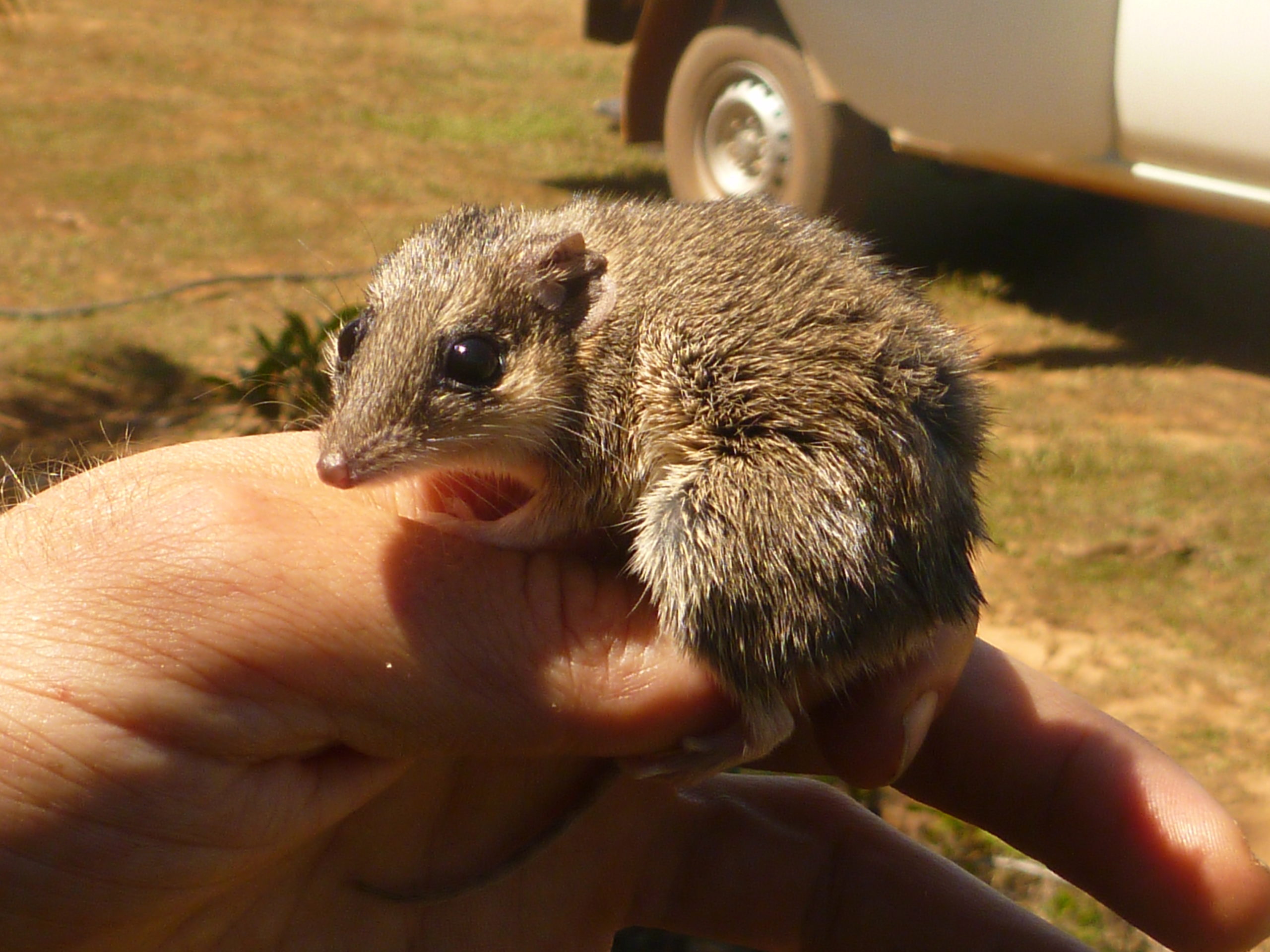
This research generated maps for many species of concern in northern Australia, such as Butler’s Dunnart. Photo: Alaric Fisher.
Invasive gamba grass is transforming Australia’s northern savannas, replacing native species with a dense stand of highly flammable grass that burns with up to eight times the intensity of native grasses. Hub research is helping the rangers at Mary River National Park in the Northern Territory turn this invasion around, through supporting adaptive management activities and documenting the effectiveness of these changing in reducing fire frequency. These management changes are enabling the regeneration of the native savanna woodlands in areas formerly infested with gamba grass.
Discover more project findings.
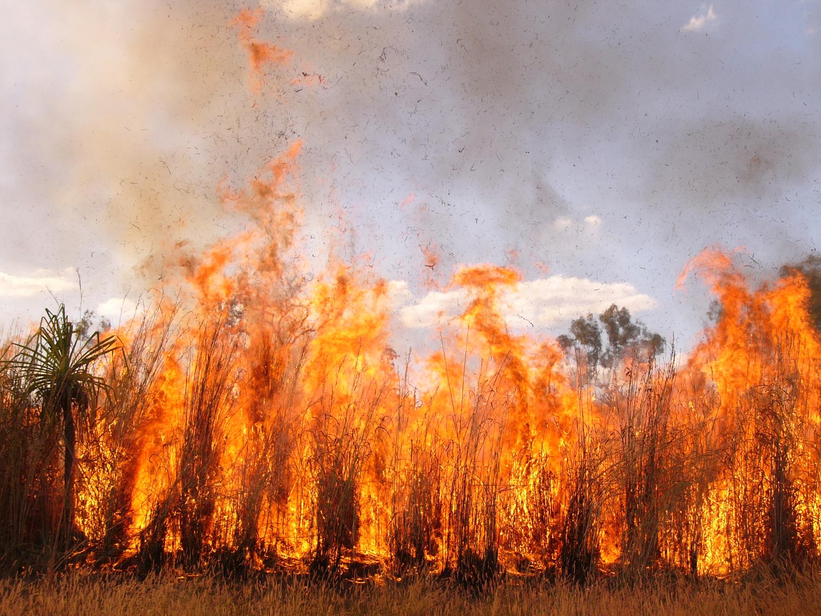
Gamba grass fires can burn at up to eight times the intensity of native savanna grass fires. Photo: Samantha Setterfield.
How do you restore the site condition of a former uranium mine? NESP researchers are tackling this restoration challenge at the Ranger uranium mine, producing new knowledge about the possible impacts on fish and riparian vegetation from potential leachate into creeks, and developing guidelines and targets for the return of local native fauna to the site. The Australian Government’s Supervising Scientist Branch will use this important research to inform their impact assessments and develop rehabilitation strategies at the Ranger mine with the guidelines and standards that are transferable to other hard rock mine rehabilitation sites across northern Australia.
Discover more findings about faunal mine rehabilitation standards, fish sensitivity to contaminated mine water and tree sensitivity to contaminated mine water. The final reports are available on the project pages too.
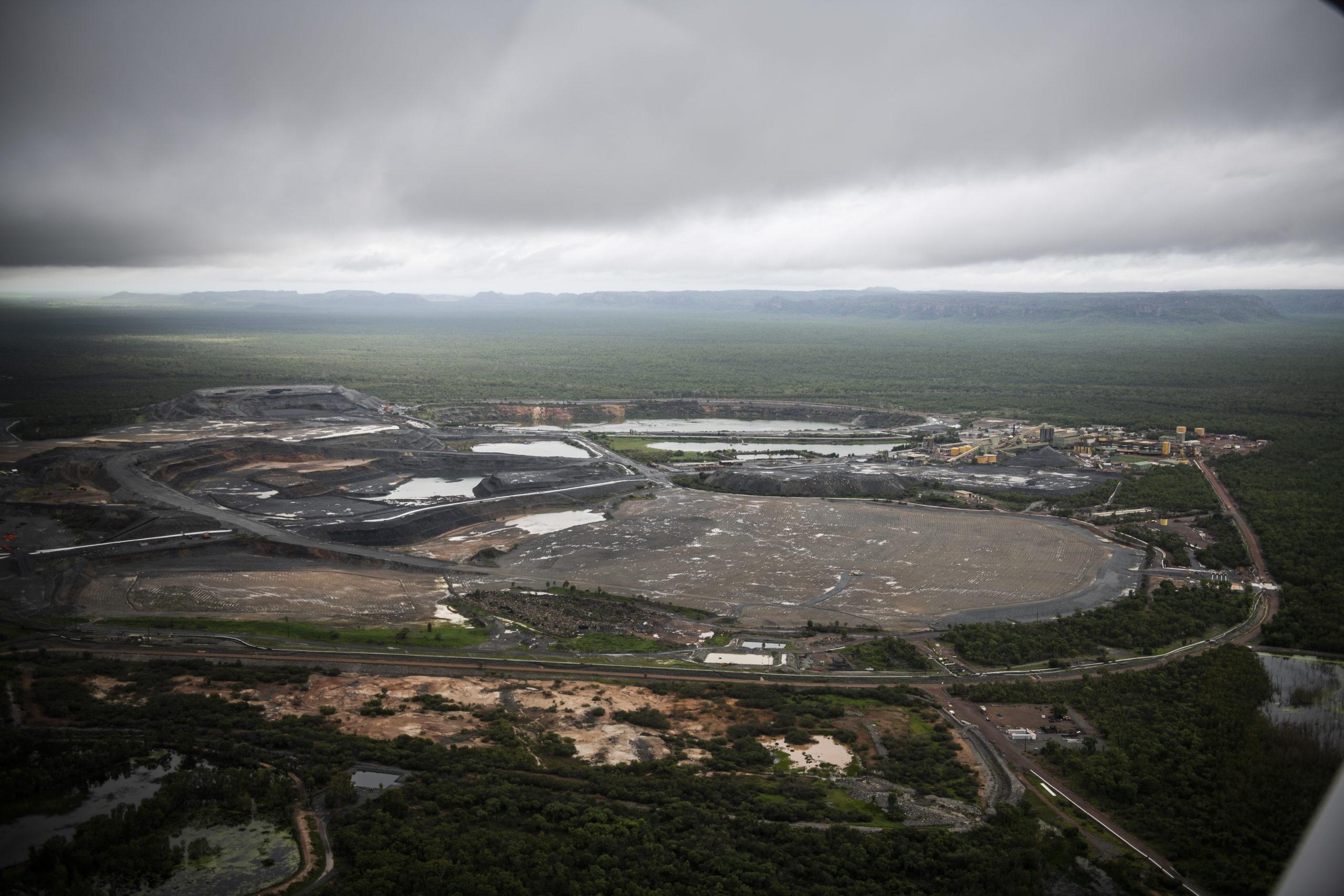
Ranger uranium mine and surrounding mine site lease and Kakadu National Park. Photo: NESP Northern Hub.
The research produced fine-scale maps of the current distribution of critically endangered littoral rainforest in Queensland’s Wet Tropics. It also produced overlay maps showing potential flooding associated with climate change and severe storms. This research has informed the recovery plan for this ecological community, and state and local governments are using the mapping. The overlay maps have significantly improved our understanding of the threats to littoral rainforest from sea-level rise, storm surge and extreme weather events, and are being used, along with the base mapping, to improve policy, planning and on-ground action to better protect and manage this unique forest.
Discover more project findings or read the final report.
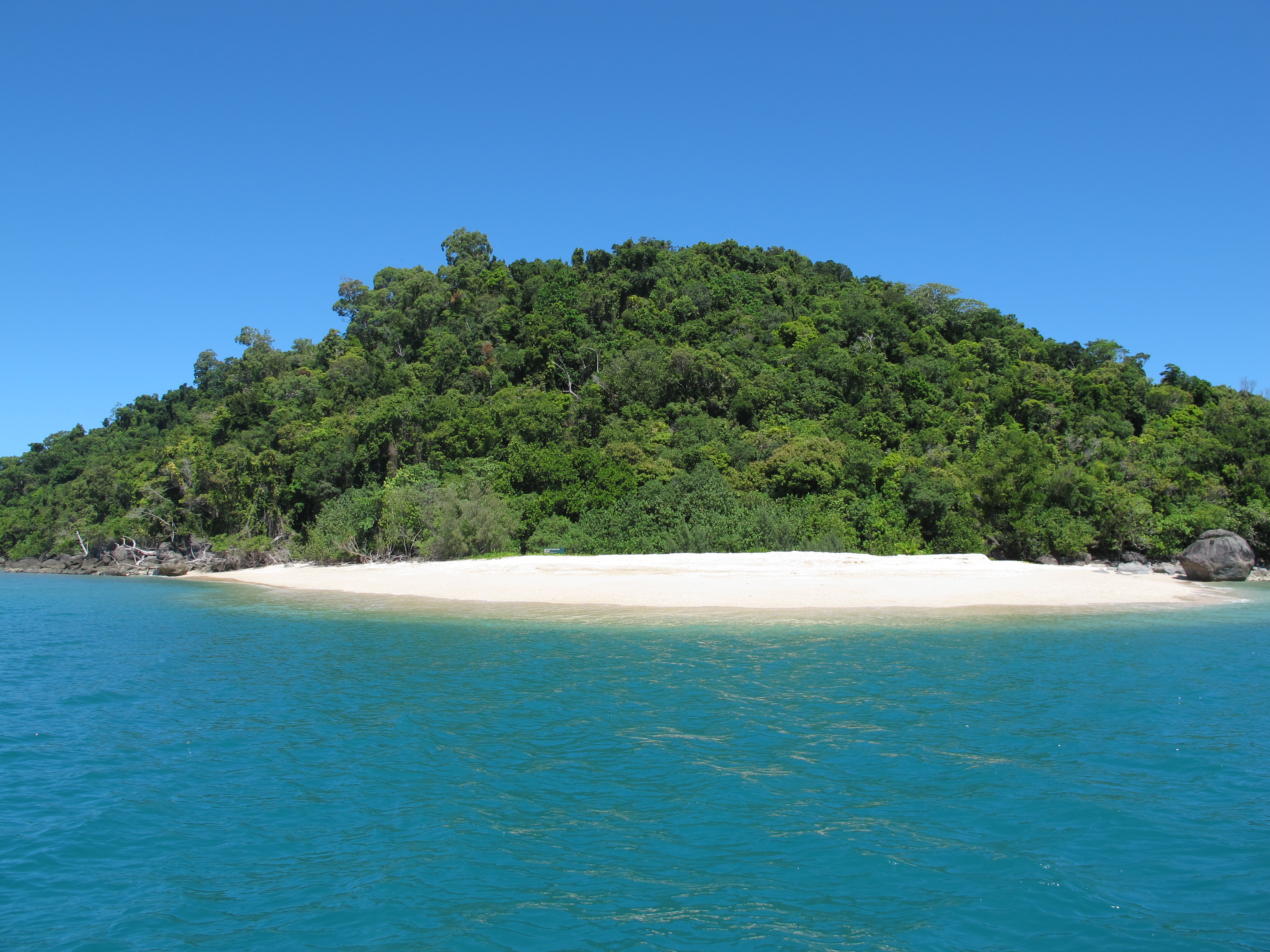
Littoral rainforest on tropical north Queensland High Island National Park. Photo: Andrew Ford.
Research outputs & attributions
Research outputs
Scientific papers
Reports
Factsheets
User guide
Videos and presentations
Impact stories
Media
Datasets available
Project webpages